

If you’re standing on the dock at Larsen Bay watching the tide pull against the pilings, you’re looking at a shoreline that was violently rearranged in a matter of minutes. The 1964 Alaska earthquake and the tsunami it triggered didn’t just shake Kodiak Island, it permanently altered the coastline, sank parts of some villages, and rebuilt others from scratch. Understanding that history gives real depth to the landscape you’ll see while fishing and exploring with us.
What Happened on Good Friday, 1964
On March 27, 1964, a magnitude 9.2 earthquake struck Prince William Sound, roughly 250 miles northeast of Kodiak. It remains the most powerful earthquake ever recorded in North America. The shaking lasted almost five minutes, long enough to trigger landslides, liquify soil, and set off a series of tsunamis that raced south toward Kodiak Island within half an hour.
Why Kodiak Was Hit So Hard
Kodiak sits close enough to the fault zone that the tsunami waves arrived with little warning. Some communities saw wave heights of over 30 feet roll through their harbors and streets. Because so many villages here were built directly on the water for fishing access, the waves reached homes, boats, and canneries almost immediately.
How the 1964 Alaska Earthquake Changed Kodiak’s Coastline
The earthquake didn’t just cause a temporary flood. It permanently dropped the elevation of parts of Kodiak Island by several feet, a process geologists call subsidence. Low-lying areas that once sat safely above high tide were suddenly within the tidal zone, and some structures had to be abandoned or relocated entirely because the ground beneath them no longer sat where it used to.
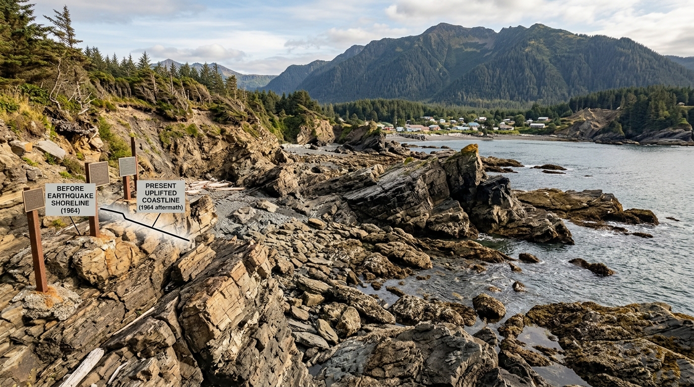
This shift also changed how saltwater interacts with the shoreline forests and tide flats. If you spend time hiking or kayaking with us, you’ll notice dead standing spruce in some areas near the water, a lasting sign of land that dropped into salt-killed ground. Our earlier piece on how the coastline’s forests were reshaped goes into more detail on what to look for on the trail.
The Impact on Kodiak Villages
Kodiak City took heavy damage, with the tsunami destroying much of the waterfront business district and fishing fleet. But the smaller villages around the island, places whose names you’ll hear during your stay, were hit just as hard relative to their size.
Old Harbor, Kaguyak, and Afognak
The village of Kaguyak was destroyed so completely that it was never rebuilt in its original location. Old Harbor suffered major flooding and structural loss but residents rebuilt on higher ground. Afognak Village was abandoned after the disaster, with many residents relocating to what is now Port Lions, a community founded specifically to resettle displaced Afognak families.
Larsen Bay’s Experience
Larsen Bay, where our lodge sits today, was fortunate compared to some of its neighbors, but the surrounding waters and shoreline still felt the effects of subsidence and the tsunami surge. The broader Alutiiq communities across the island, whose presence here predates the earthquake by thousands of years, absorbed both the immediate damage and the long recovery that followed. If you want context on the people who called this coastline home long before 1964, our article on the Alutiiq people’s history on Kodiak Island is a good place to start.
Rebuilding and Recovery
Recovery took years, not months. Federal and state disaster relief helped fund the rebuilding of docks, canneries, and homes, and some communities used the disaster as an opportunity to move to higher, more stable ground rather than rebuild in place. The fishing industry, which was and still is the economic backbone of the island, had to rebuild boats, gear, and processing facilities from near total loss in some harbors.
That rebuilding effort is part of a longer thread running through Kodiak’s story, from Russian fur trading posts to the commercial fishing fleets that define the island today. Our overview of Kodiak’s fur trade and fishing frontier past traces that arc in more detail if you’re curious how the island got to where it is now.
What You’ll Notice on Kodiak Island Today
Six decades later, the marks of the 1964 Alaska earthquake are still visible if you know where to look. Some of what feels like a naturally rugged coastline is actually the result of sudden geological change.
- Ghost forests of dead spruce near tide lines, a sign of land that dropped after the quake
- Rebuilt harbor infrastructure in Kodiak City and surrounding villages
- Relocated communities like Port Lions, founded specifically after the disaster
- Tsunami warning signage and evacuation routes still maintained along the coast
None of this makes the island feel unstable today. If anything, it adds weight to how resilient these communities and this landscape have proven to be.
Fish and Explore Where History Runs Deep
Understanding what shaped Larsen Bay and the waters around it makes the fishing and wildlife you’ll experience here feel even more grounded in place. Whether you’re out on one of our halibut fishing charters, chasing salmon through the same waters these villages depended on, or hiking a shoreline trail on a kayaking excursion, you’re moving through a landscape with a real story behind it. Get in touch with us to plan a trip built around your fishing goals and curiosity about this remarkable island.